
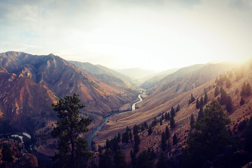
While on a Middle Fork Salmon River trip, a common question is, “What is the elevation?” Understandably, the corridor can be a bit disorienting. With a constantly changing landscape, from high alpine forest to steep canyon walls, all while floating 100 miles, it can be tough to even guess your elevation. Often, you will be surprised to learn the elevation along the river. Below are some helpful elevation sites you will likely encounter during the course of your trip.
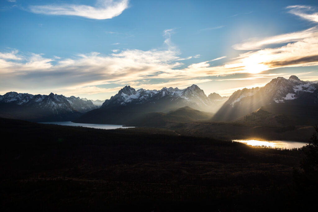
10,751 ft. Thompson Peak. The highest peak in the Sawtooth Mountain Range.
7200 ft. The beginning. The headwaters of the Middle Fork begin at the Bear and Marsh Creek confluence, which is a part of the runoff from the Sawtooth Mountains.
5,652 ft. Boundary Creek boat launch. The launch point is over a mile high.
5,515 ft. Soldier Creek. This creek joins the river just across from Joe Bump Camp. Solider Creek flows off of Big Soldier Mountain, which boasts an elevation of 8,909 feet.
5,000 ft. Greyhound Creek.
4,760 ft. Pistol Creek Rapid. This challenging rapid keeps things interesting at all flows.
4,650 ft. Indian Creek Airstrip and Launch Site. The airstrip sits just above the pine groves that grow on either side of the river here. Incoming planes catch a stunning view of the Middle Fork corridor. The landing strip at Indian Creek is the longest on the river, at 4,650 ft in length.
7,641 ft. Scarface Mountain. This is one of the prominent peaks visible from the river.
4,415 ft. Thomas Creek Airstrip. This 2,100 ft. long landing strip is a late-season launch point near a popular camp.
4,000 Feet: Loon Creek flows into the Middle Fork at Mile 50, the halfway point. The airstrip at Loon Creek is only 1,200 feet long, making it the shortest runway on the Middle Fork.
3,770 ft. Camas Creek. This tributary flows into the river at Mile 60, next to the popular Camas Camp.
3,600 Feet: Flying B Ranch. This backcountry lodge sits on a calm stretch of river just before Haystack Rapid. It has a 2,100 ft. airstrip.
4,486 ft. Johnson Point. This scenic overlook is accessed by a hike from Little Pine camp. The staggering view requires around 1,200 feet in elevation gain.
3,400 ft. Big Creek. The Middle Fork Trail ends when Big Creek joins the river. It is the start of the Impassable Canyon.
3,260 ft. Ship Island Camp. Across the river is Ship Island Creek. The creek flows from Ship Island Lake at 7,840 Feet.
3027 ft. Middle Fork Salmon Confluence with the Main Salmon. The confluence marks the end of the Middle Fork of the Salmon. The takeout is only a few miles downstream.
2985 ft. Cache bar. The Middle Fork Salmon take-out.
Great videos and photos. Brings back good memories. Too bad, I am just to old to go again.